A Golden Anniversary on Hawaii's Big Island
June 4 through June 11, 2011
We arranged for all of our children and their children to join Janet and me on the Kona Coast of Hawaii. The pictures below are a partial record of that trip and our celebration.| Arriving at the open-air Kona airport, there are a lot of reminders that you are not in Kansas anymore. |
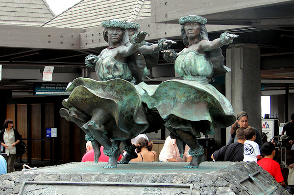 |
| Another big reminder, Janet's lei, hand delivered. | 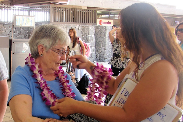 |
| We stayed at a condominium complex called Kolea. | 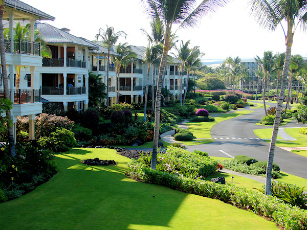 |
| We all stayed in Building 6, seen here from the beach. | 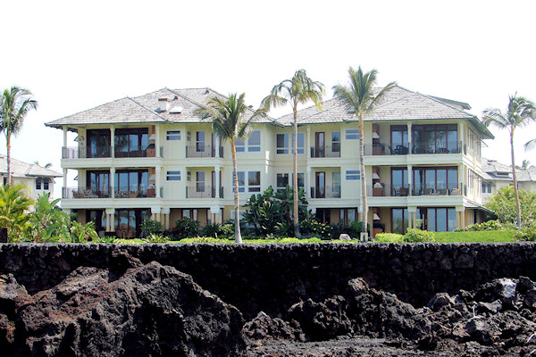 |
| We occupied two units, 6B and 6E, highlighted here. Trouble was, going from unit to unit involved two sets of stairs or elevators. Between the two units, we had six bedrooms, just enough. | 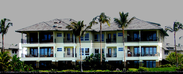 |
| From the lanais of our condos we looked out on 'Anaeho'omalu Bay, which is going to be A Bay from here on. It is nice and protected, but part of its beach was swept away by the tsunami that hit here on March 11, 2011. | 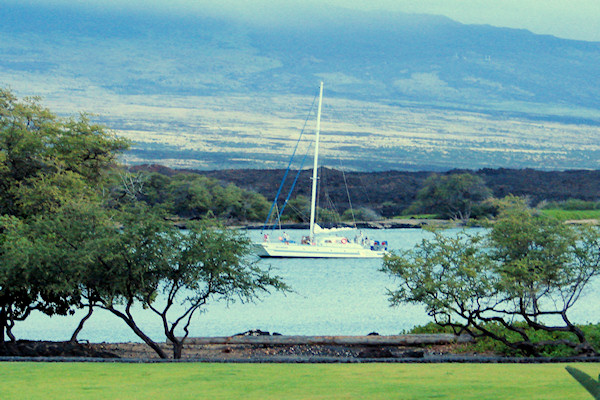 |
| Speaking of lanais, Eamonn managed to get a picture of all of us on the lanai of 6B. Actually, this was June 10. I can tell because everyone is dressed up. (Eamonn has just outrun the timer on his camera.) | 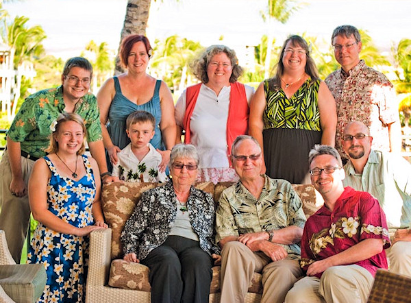 |
| One of the big surprised is that the Kona Coast is a near desert. Only ten inches of rain a year, and there are a lot of lava fields. Real desolation. However, the resorts are all irrigated, and really green. | 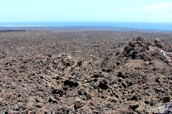 |
| Where the lava fields meet the ocean, the beach looks more like something on the California coast. This is part of A Bay. | 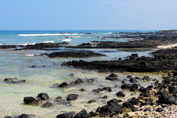 |
| Sea turtles like A Bay. Swimmers have to avoid them, and they even take naps on the beach, in multiples. | 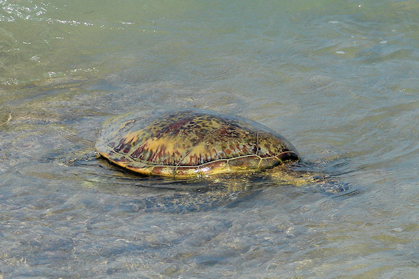 |
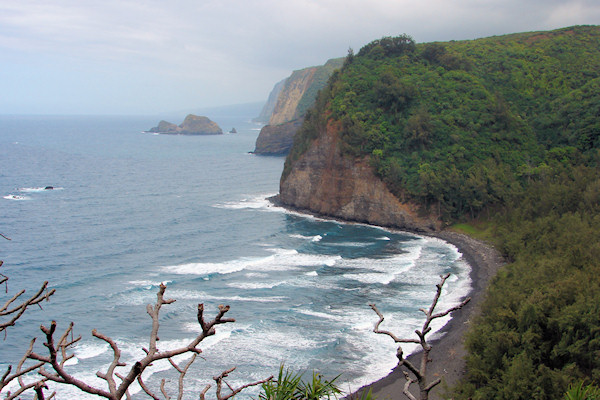
| We went to the North part of the Big Island, and this is a
view of Pololu Beach, at the head of Pololu Valley. Too rough for
swimming. Pretty rough to get to, as well. The younger
generation made it clear down, but not me. I didn't get a picture of World's Surliest Waitress on the way up here. |
 |
| King Kamehameha the Great united Hawaii in 1795, and this is the original 1878 statue. It is actually a bit smaller than I had expected. Why should it have been bigger? Maybe because of "the Great" applied to his name. | 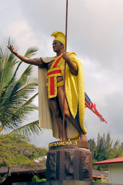 |
| About 50 feet from King Kamehameha, Cy and Tyler found a first class rock. Good for climbing, good for lounging. | 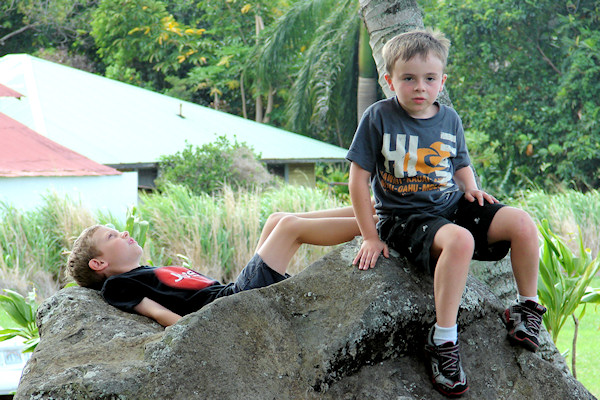 |
| Heading south, our first stop was at the Painted Church. St. Benedict's Catholic Church goes back to 1842, but it was moved from its original shore location to the Kona coffee elevation in 1899. Around that time, the priest set out to paint murals and other decorations. This picture shows a trompe l'oeil view of a Gothic chancel behind the altar. | 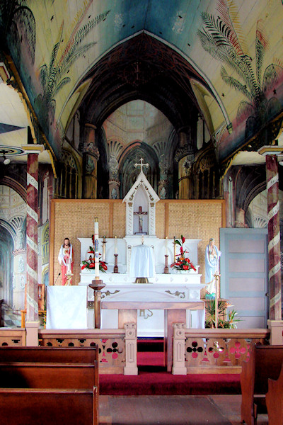 |
| Pu'uhonua o Honaunau is a "place of refuge" going back to the 16th century. Even trivial infractions could result in execution, but if a a miscreant could get here, he and his family could be spared. Doug and his family found some great snorkeling about 100 yards to the right of this point. | 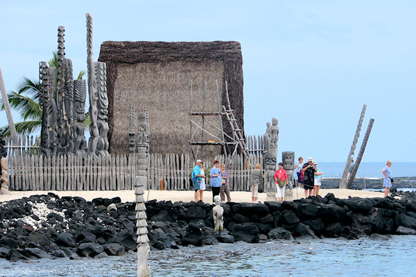 |
| At the extreme south end of the Big Island, we find the southernmost point in the United States. We also find some awesome cliffs. | 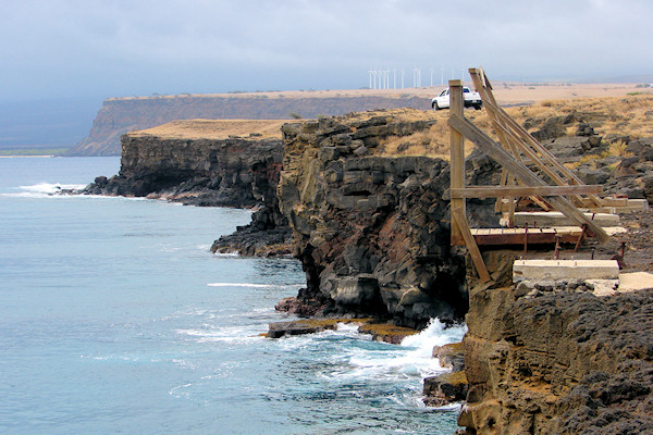 |
| On the top of Kilauea we found a surprise. This is a rain forest! They get about 180 inches of rain per year. No sign of the sun while were there. | 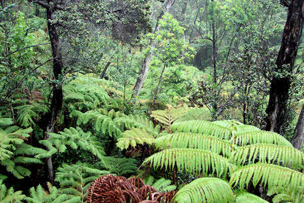 |
| Less surprising was the Thurston Lava Tube. This is the part that had no lights. I pointed the camera at the voices and let the flash do the rest. Overall, between the lighted and dark parts, this tube must be about a third of a mile long. The dark part is REALLY dark. | 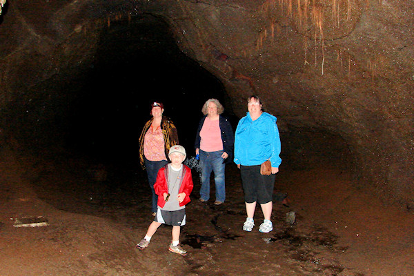 |
| There were no active vents when we visited Kilauea. Within its principal caldera, there is Halema'uma'u Crater. Somewhere down that hole there is a pool of molten lava, but it just sits there and smokes. | 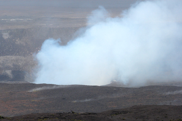 |
| Maybe the night shot of Halema'uma'u Crater would be more convincing. Not only is this in the dark, it is raining. (Not too many pauses allowed if you are going for 180 inches per year.) | 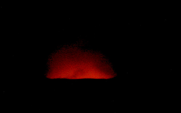 |
| Still within Volcano National Park, the Chain of Craters road reaches the sea near this, the Holei Sea Arch. | 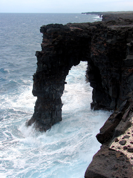 |
| Will and Janet are trying the furniture near the Sea Arch. | 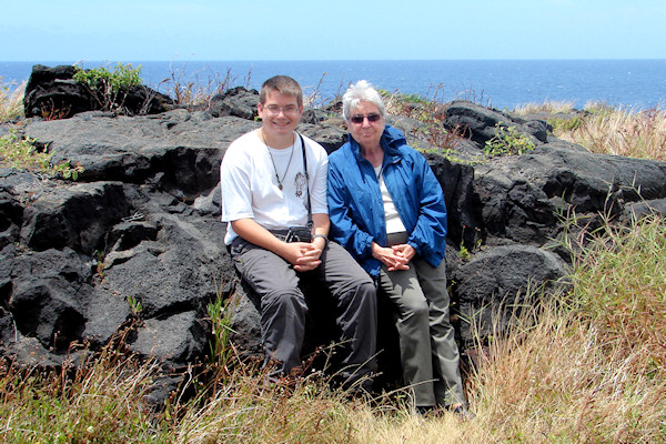 |
| Heading east from Kilauea and north from Hilo, we went to 'Akaka Falls. The walk into the falls goes through more rain forest. This is more like a jungle than Kilauea. | 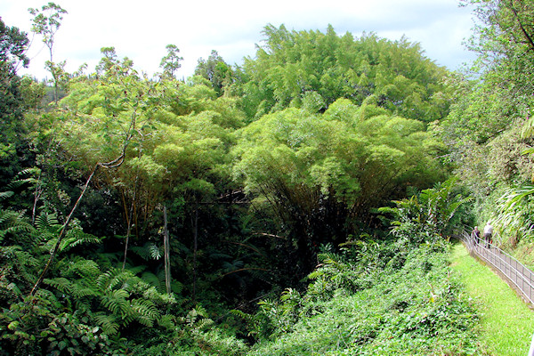 |
| And here is 'Akaka Falls. A drop of 420 feet. As we walked back, we got more rain. However, while the rain on Kilauea was misty, tiny drops, this rain was huge, juicy globs of water. Completely different character. | 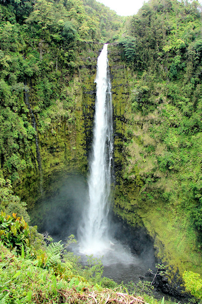 |
| June 10, Friday night, was celebration time. Fifty years married. (Credit goes to Eamonn for this and several of the succeeding pictures.) |
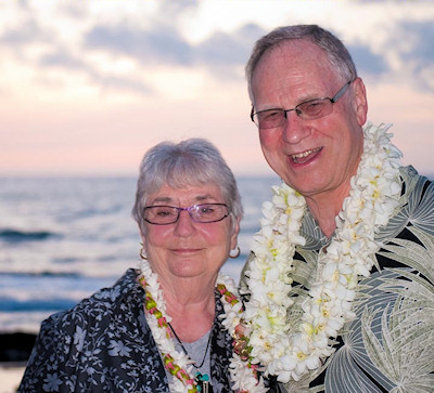 |
| The kids hosted a great dinner at the Four Seasons' Pahu I'a restaurant. Close to the surf, as you can see. Actually, the restaurant was inundated by the tsunami, and it was closed for about 6 weeks. (I just discovered that Pahu I'a means "Aquarium.") | 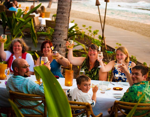 |
| Here we are with our children. | 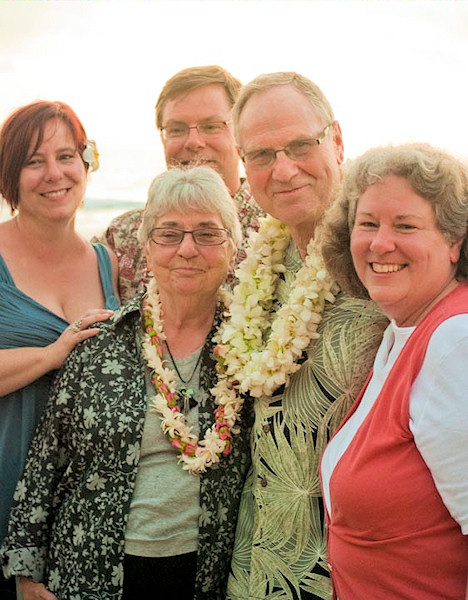 |
| Here we are with our grand children. | 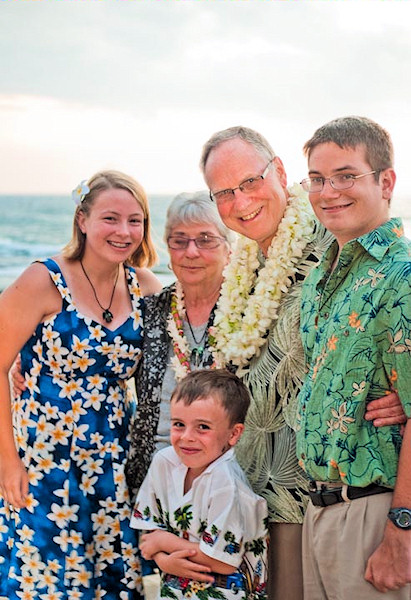 |
| And here is the whole party, on the beach at Pahu I'a. | 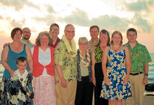 |
| At the end, we had a huge cake. Doug and I both estimated the size of the pieces and multiplied by 11, and we didn't come up with 360°. Somebody else must have gotten fat, too. | 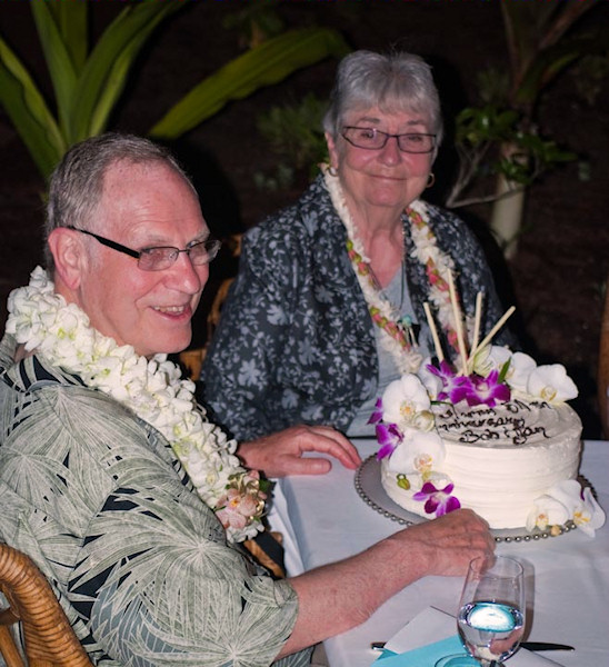 |
| It is mandatory that you wrap things up with a sunset. This is a sunset over A'Bay. Palms and lava, sun and sea. It was a good week! | 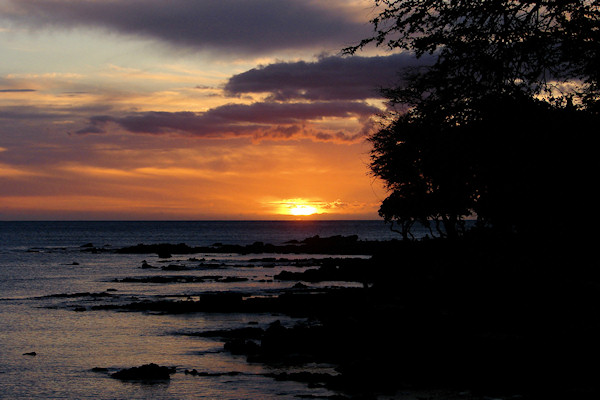 |
| Return to the home page | |