| Koper and Environs, Slovenia | |
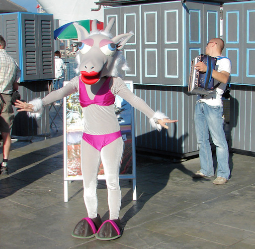
| When
we left the ship in Koper, Slovenia, we were met by entertainers.
Why the horse look? The Lipizzaner horses are the
national
animal of Slovenia. Slovenia, with a population of a little over 2 million, is the most prosperous of the countries that used to comprise Yugoslavia. |
 |
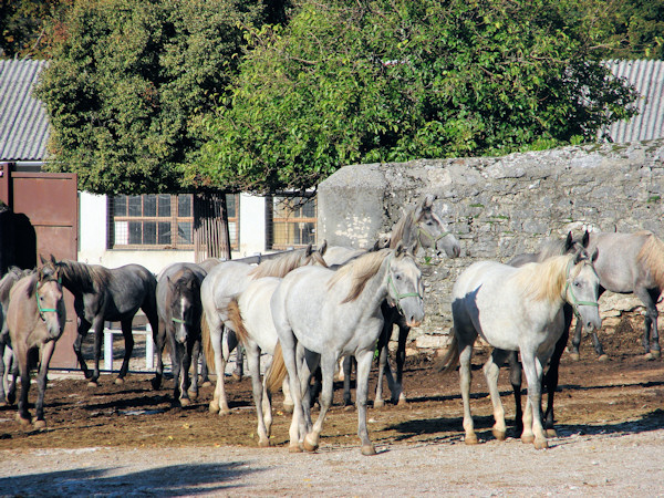
| Our
first stop in Slovenia was the Lipica Stud Farm, which was the original
source of the Lipizzaner Stallions. These horses are famous for their
performances at the Spanish Riding School in Vienna.
When this all started, Slovenia was part of Austria. Here we see the mares on their way to pasture. Many are carrying foals. The white color of the Lipizzaner stallions develops with age, usually taking about 7 years. |
 |
| The stallions are trained to perform a variety of maneuvers, including the high stance shown here. | 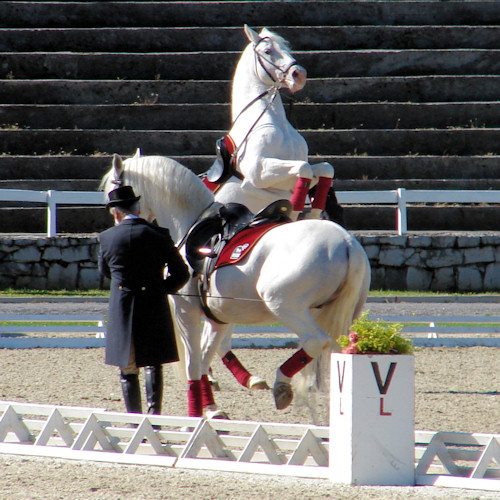 |
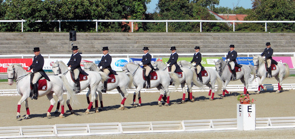
| And they perform in groups, to music. Late in WW2, General Patton took an active role in rescuing the Lipizzaners. |
 |
| Our next stop in Slovenia was the village of Piran. This is part of its harbor area. | 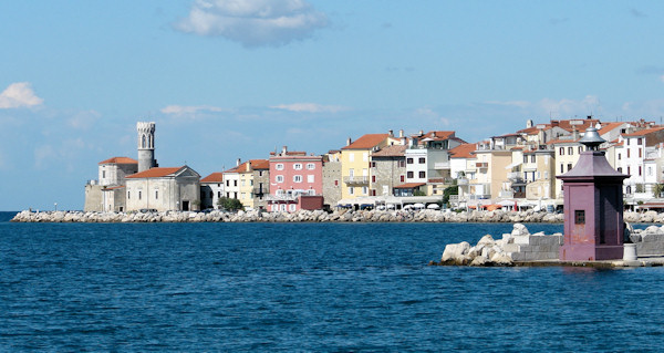 |
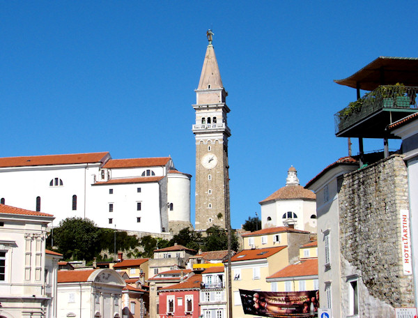
| The
central part of Piran is rich with medieval architecture. The
tower is a replica of the campanile in Venice, but not as tall.
(Piran was once part of the Venetian Republic.) Piran's most famous citizen was Giuseppe Tartini, a composer and violinist, born here in 1692. His most famous piece is known as the "Devil's Trill Sonata." |
 |
| High above the town of Piran, you can see a town wall. While the first town wall was built around 700 AD, this is a late addition. It was built between 1470 and 1534. | 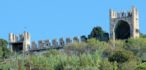 |
| Split, Croatia | |
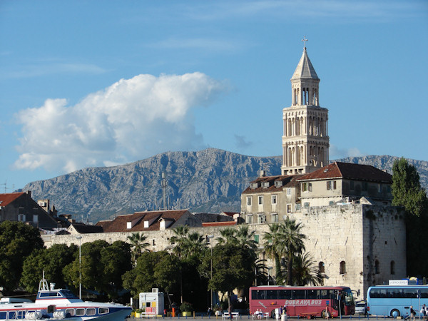
| Split was the largest Croatian city we
visited, but it was hard to tell because we concentrated on
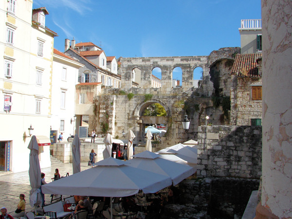
the Diocletian's Palace. Roman Emperor Diocletian decided he wanted to retire in this area, not too far from where he was raised. He built a classical Roman palace. When it was finished in 305 AD, he retired and moved in. Having a true retirement was unusual for a Roman emperor. This is the palace, as seen from the Split harbor. |
 |
| Diocletian's Palace is fortified like a military bastion, with heavy duty walls and gates. It is almost 10 acres inside, and when Diocletion lived here, there were another 8,000 to 10,000 people living inside the walls. | 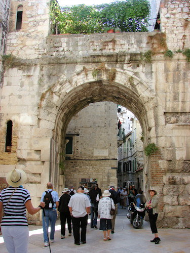 |
| Beneath the palace, there are a number of barrel vaulted galleries. They were used for storage, and probably used by the guards, as well. | 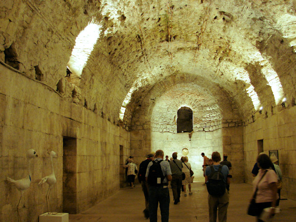 |
| Now the basement is used for tourists and for art shows. Those white things are Art, believe it or not. | 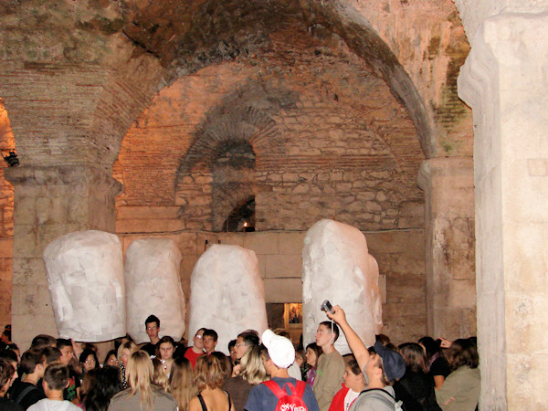 |
| After
Diocletian died in 311, the palace fell into disuse, but in 639, the
surrounding communities were attacked by barbarians. The
heavy
walls of the abandoned palace looked pretty inviting, so Split started
its growth. This is a courtyard with residences on one side and a church on the other. |
 |
| This is the church, Cathedral of Saint Duje, and most of it used to be Diocletian's mausoleum. There is some irony here, because Duje was martyred (beheaded) by Diocletian in 304. | 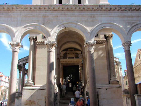 |
| Of course, the bell tower was a late addition, like 1100 AD. | 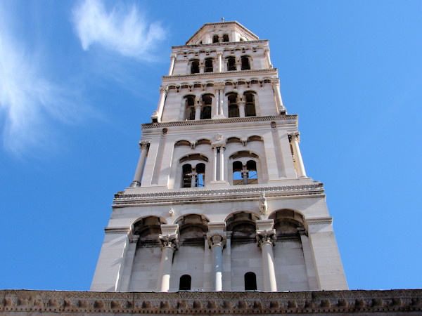 |
| As part of the palace complex, there was a waiting room for people needing to see the Emperor emeritus, the vestibule. As you can see, it is round, tapering as it goes up. There is a male chorus, the Vestibule Choir, that sings in here. The acoustics are very complimentary to the singers. | 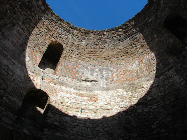 |
| Bishop Gregory of Nin, was a reformer before reformation became fashionable. He opposed the pope and introduced the use of Croatian, rather than Latin, in church services. His statue stands just outside the palace. | 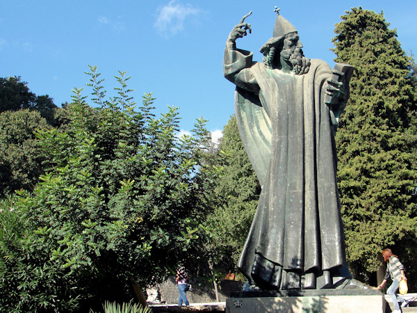 |
| Hvar, Croatia | |
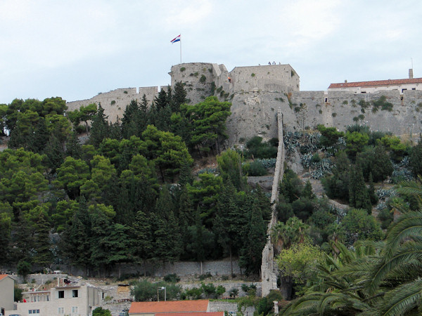
| Overlooking
the town of Hvar, the most populous on the island of Hvar, we have the
Spanish Fortress. It was designed by Spanish engineers, but
funded by the Hvar's salt sales in the 16th century. It
provided
protection from the attacking Turks. Hvar was probably our favorite port of call. |
 |
| Looking down from the Spanish Fortress, you can see the harbor. This is one of the features that made Hvar attractive to the Venetians, who governed it from time to time. | 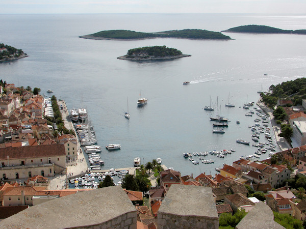 |
| This is the old cathedral square, from the Spanish Fortress. | 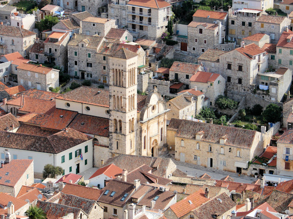 |
| A closer view of the Cathedral of St. Stephan, which dates from the 14th through 17th centuries. The bell tower is 17th century. | 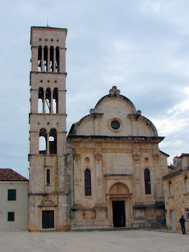 |
| This Baroque altar in St. Stephens, which probably dates from the 14th century. | 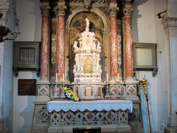 |
| The loggia of the 15th century palace, once occupied by the Venetian governor, has been integrated into the Palace Hotel. The clock tower also remains from the same palace. | 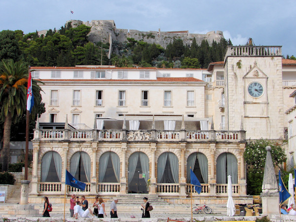 |
| One of Hvar's hidden villages. This is Velo Grablje. Hvar's hills and valleys provided places for people to live without being visible to the Turks or whoever else was prowling the Adriatic, looking for places to loot. | 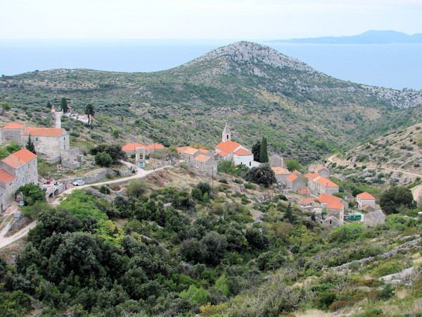 |
| In central Hvar, the hillsides are partitioned by stone fences, but these fences seem to predate all available history. | 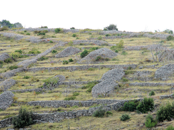 |
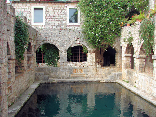
| The
place now known as Stari Grad was populated by the Greeks in about 374
BC, and they called the place Pharos. Stari Grad is on one
side
of the island and Hvar is on the other. One of Croatia's most famous poets, Petar Hektorović, built a fortified home in Stari Grad in the first half of the 16th century. Sort of a dull toad outside, it has gardens and this koi pond inside. |
 |
| Dubrovnik, Croatia | |
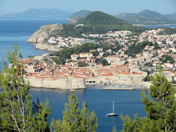
| Dubrovnik
is called "The Pearl of the Adriatic." This applies to the
old
walled city. In fact there has probably been a walled city
here
since the 8th century, but the present walls, about 1¼ miles long, were
constructed between the 12th and 17th centuries. This old port contributed to Dubrovnik's mastery of the sea along the Dalmatian coast. |
 |
| The land side walls are as much as 80 feet high, and up to 20 feet thick. They were intended to protect against the Ottomans, among others. | 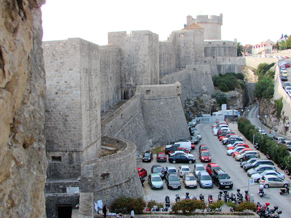 |
| Looking down on Dubrovnik from the land side walls. | 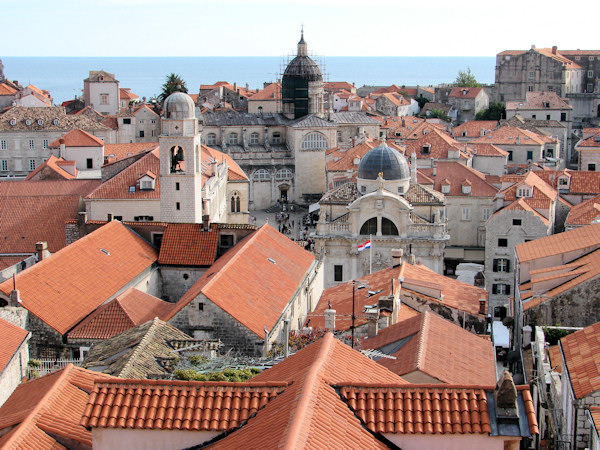 |
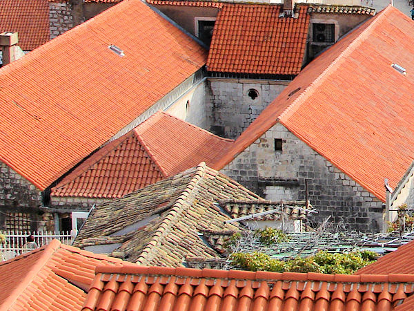
| Note
that the roofs come in two different colors, with the bleached red in
the minority. When Yugoslavia was breaking up, Dubrovnik was
under siege for 7 months, starting in October 1991. During
that
time it was subjected to repeated artillery attacks from the
Serbian-Montenegrin army in the hills east of town. The
bright red
roofs are the consequence of reconstruction done between 1992 and 2006. The siege killed 114 civilians, and undamaged, pale-roofed buildings are few and far between. |
 |
| Placa Stradun is the central artery of Dubrovnik. At the near end, we have the Pile gate, and at the far end the Rector's Palace, a remnant of the Republic of Ragusa. Beyond the palace, you find the Ploče Gate. | 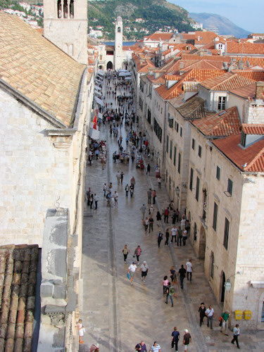 |
| Looking back over the city, the Jesuit church of St. Ignatius towers over the sea side walls. | 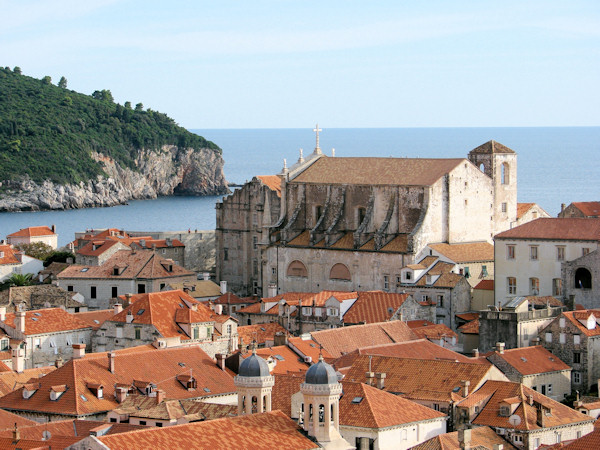 |
| The Church of St. Ignatius overlooks a square that is relatively free of tourists. It is accessed by stairs, probably copied from the Spanish Steps in Rome. | 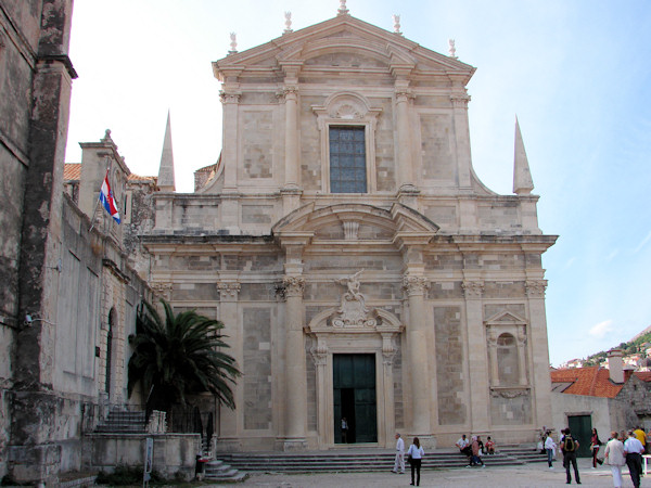 |
| This is the Baroque interior of the Jesuit church. | 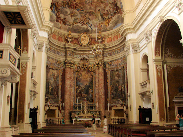 |
| The Church of St. Blaise, the patron saint of Dubrovnik, faces the Rector's Palace across a busy square. Since we were here on a Saturday, the dancers were performing. | 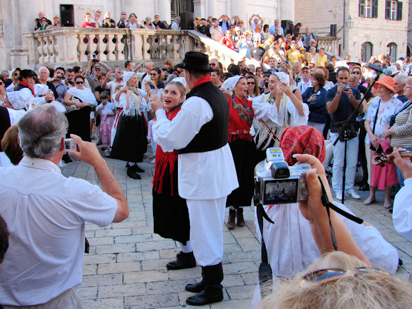 |
| During the Republic of Dubrovnik era, one of the leading citizens served as Rector, a rotating position with a term of one month. During that month, the Rector stayed in the palace on the right continuously, governing the Republic for that term. Dead ahead is the Sponza Palace. | 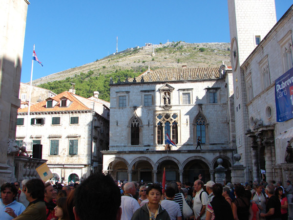 |
| The courtyard of the Sponza Palace, home to several important offices of the Republic. This construction of this building dates from about 1522. This palace survived the earthquake of 1667. | 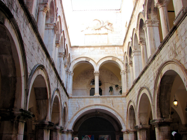 |
| This is the cloister of the Franciscan Monastery. Even today, it is a quiet place in Dubrovnik. There is also a Dominican Monastery. | 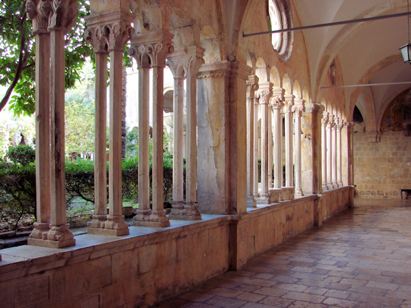 |
| Cavtat, Croatia | |
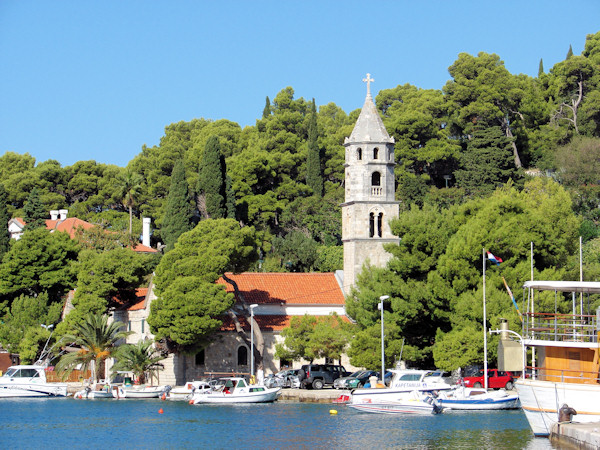
| Cavtat
was a stop by coach, after leaving the ship at Dubrovnik. Cavtat, now a village of 2000, is actually the older town. It was founded by the Greeks in the 6th century BC, then taken over by the Romans in 228 BC. When the Slavs attacked the town in the 7th century (AD), the occupants fled north and founded the town that has become Dubrovnik. This tower is belongs to the Dominican monastery. |
 |
| Another view of the town and harbor. | 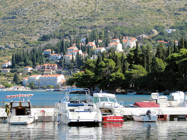 |
| We had a series of meals at country wineries, and most offered wine, Mediterranean ham, cheese, bread and grappa. This scary setup could be the grappa source. | 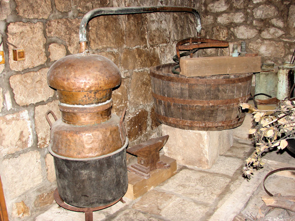 |
| Herceg Novi, Montenegro | |
| Herceg
Novi is a new town, founded in 1382. Its Italian
name
translates to New Castle. It has been occupied by about
everyone,
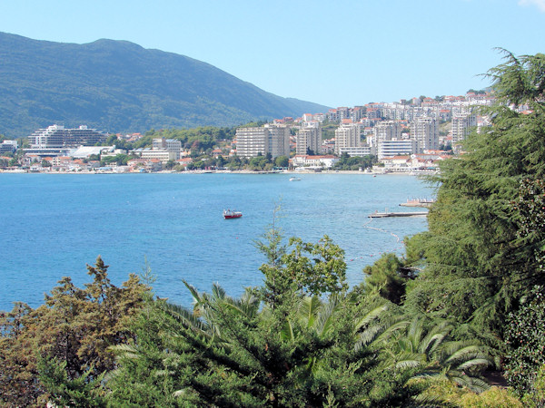
in its short life. The Ottomans were here for about 200 years. Montenegro actually uses both the Latin and the Cyrillic (Serbian) alphabets, so the other name for this town is Херцег Нови. This is a reminder of the Slavic background of this area. The view from our hotel is one arm of the Bay of Kotor. |
 |
| This satellite view (by Pavle Cikovac) shows the Boka Kotorska or Bay of Kotor. It is sort of like a four-leaf clover. From the roads and towns around the bay, it looks like a fjord, but it is a river bed, and the deepest point is only 200 feet deep. Note the narrow neck. There is a ferry that crosses there. More on that later. | 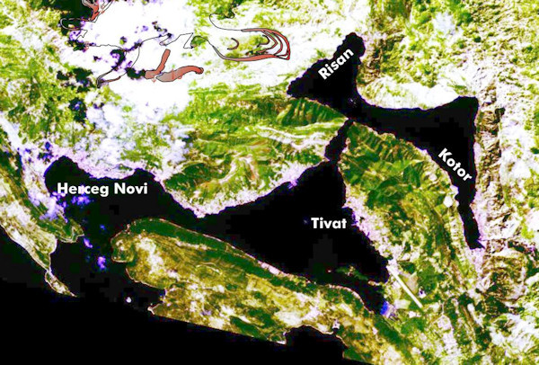 |
| Below the old town of Herceg Novi, there is a fortress known as Forte Mare. It overlooks the Bay of Kotor. The origins of this fort go back to King Tvrko (a Bosnian) in 1382. | 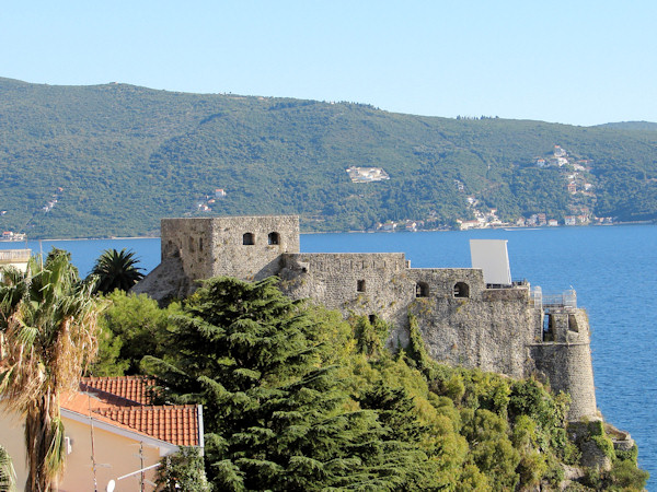 |
| The lower piece of Forte Mare is connected by a stone bridge, and traffic passes beneath it with difficulty. The mirror is supposed to prevent crashes. | 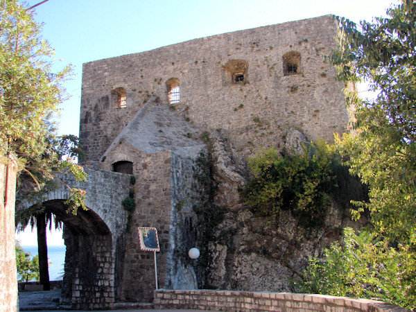 |
| The Belavista Square is sort of a town center. It is overlooked by a clock tower built by the Austrians in the 19th century. Farther up the hill, there is a prison tower built by the Turks, and it is known as the Bloody Tower. | 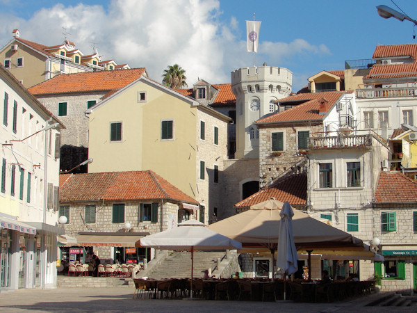 |
| Finally, night in Herceg Novi shows why you like to be on the water. | 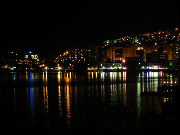 |
| Budva and the Montenegrin Riviera | |
| To reach Montenegro's Riviera, which lies on the Adriatic south of the Bay of Kotor, a ferry saves a lot of time. This crossing is not quite at the narrowest part of the bay. | 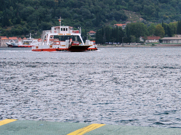 |
| Looking inland from the ferry, you can see two churches through the Verige strait, the narrowest part of the Bay of Kotor. The town of Perast is just to the left of this strait. | 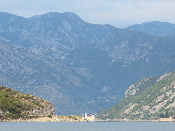 |
| Perast is the home of the two churches on two islands. One is St. George, and the other is Our Lady of the Rock. The latter church is on the only man-made island in the Adriatic. It was built up to about 3000 square feet after sailors found a picture of the Virgin Mary on a rock in 1452. | 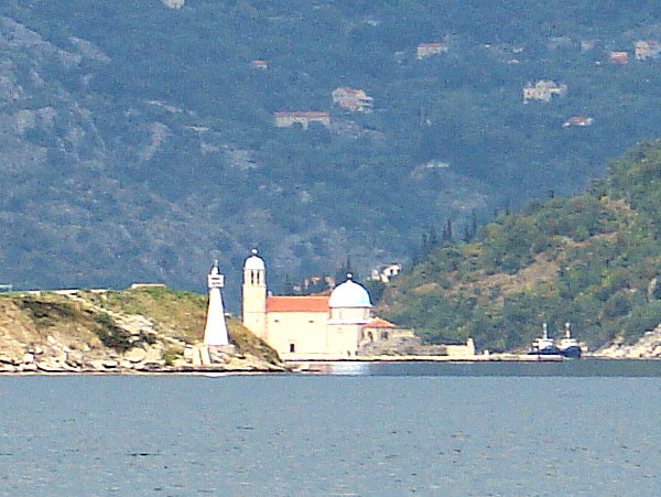 |
| While Budva has modern hotels and residences, old Budva is defined by the walls built while it was part of the Venetian Republic, a period of about 400 years from 1420 to 1797. These walls were intended to repel the Ottoman Turks. | 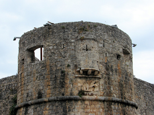 |
| Within the walls you find Roman as well as Venetian ruins. These are two separate churches. St. John's church on the left probably dates to the 7th century. St. Mary's of Punta dates to around 840. |  |
| Holy Trinity is an active Orthodox church, but it is new, dating to 1804. |  |
| This is the mosaic above the door of Holy Trinity. | 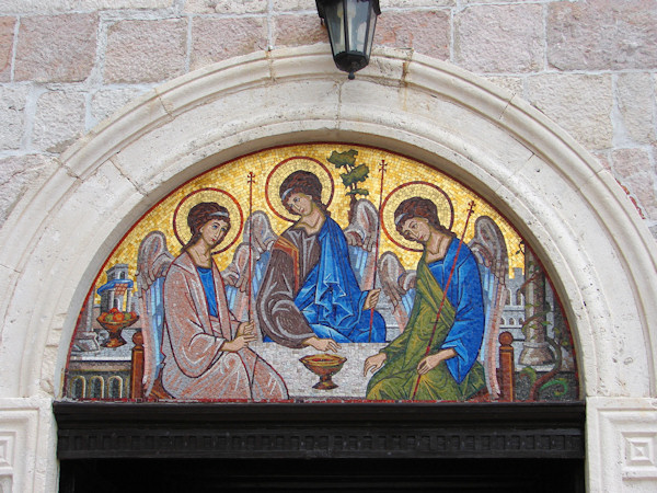 |
| St. Stephen's was a fishermen's island in the 1500's, but around 1950 the fishermen were kicked out. The island was turned into a resort/hotel/village, a world class, Five-Diamond facility. It fell into disrepair during the civil war in the 1990's. The resort was reopened in the summer of 2010, not long before we were there. | 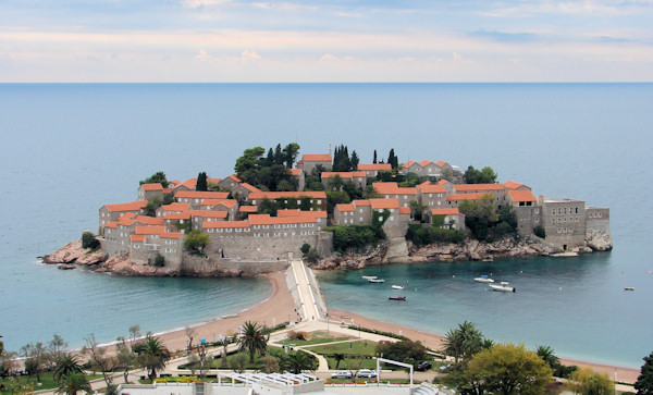 |
| This is really two islands, St. Nedeja with the church, and Katic with the trees. They are just a few hundred yards off shore from the village of Petrovac. | 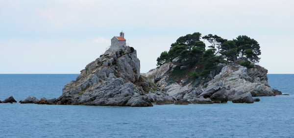 |
| Petrovac has a nice harbor, but its shoreline is rugged, as suggested by this sea cave. | 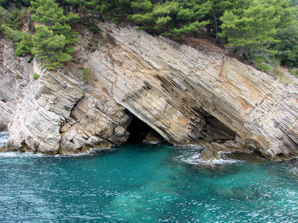 |
| Kotor, Montenegro | |
| Kotor should have been one of our best stops. It is a well preserved, walled town. However, it was raining cats and dogs. Water was running an inch deep in the plazas and well over that in the passageways between buildings. | 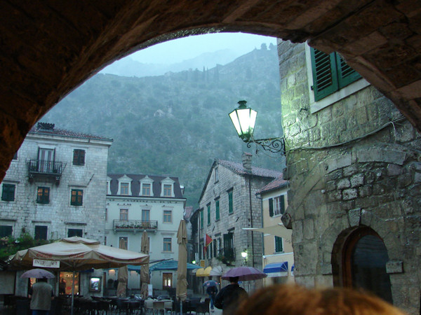 |
| Our party, not really prepared for the awful downpour, took refuge in the Kotor city gate. | 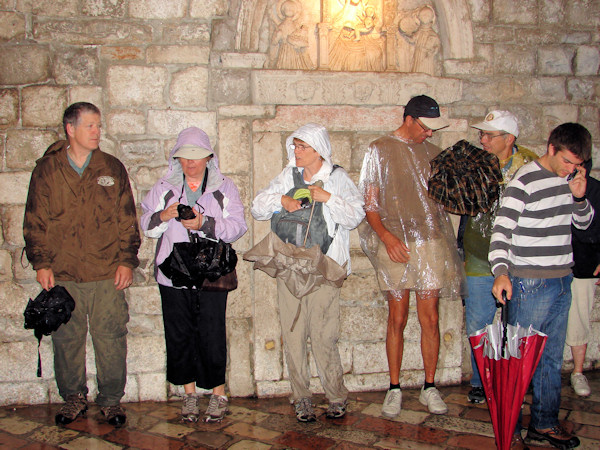 |
| Return to Part 1 | Return Home |